Boundary Select; Gebiedselectie
PDOK in Excel
E-Maps first slider

Excel E-Maps gives you professional maps within Excel. Plot your addresses, make thematic, analyze, vizualize and save high quality maps in your report.

new_symbols-slider-v3

New thematic colouring in Excel E-Maps. Select symbol and vary the shading.

Reduced_and_no_roads-slider

Three simplified new map layers have been added to E-Maps Pro, Advanced and Mobility. These maps give you tools to create contemporary reports. The three new map layers are: Reduced (no streets), Hybrid (no labels) and Terrain (no labels).

pdok kaartlagen

New heatmap settings Always wanted to change the colour scheme of the heatmap? Or do you need different colors to emphasize the importance of locations or negative values? Heatmaps are widely used to analyse and visualise density and intensity of data. E-Maps supports both heatmaps based on density and heatmaps based on...

MapCalcHeader

To get more insights in your data, we added a statistic feature. When selecting objects on a map or rows of data in a sheet, you can quickly see the Min, Max, Average, Count and Sum of the data. Select a specific column first for the data you are interested in. This function is more then...

Project_overview-slider

Save your map project in Excel The most wanted feature in Excel E-Maps is available now in E-Map Pro. Save your map layers, points, heatmap, thematics in a Project file. The project file (a file with ’emp’ file-extension) stores information on your Excel spreadsheet, the tab you geocoded, and from...

radius_select_grey-slider

New feature in E-Maps – circle selections From February 2017 First Element added circle selections as standard option in E-Maps Pro, Advanced and Mobility. This feature is added on request of our users. Cirkel selections are useful to have spatial insights around a location. For more advanced selections, you can use the...

previous arrow
next arrow
Shadow
gisviewer: vlakkenkaart Excel E-maps

Excel E-Maps 2.1

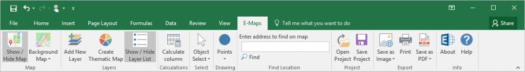
Put your location data on a map in Excel™, just in a few clicks! Excel E-Maps is the user friendly GIS viewer for all Excel desktop versions.

Specifications

E-Maps for Excel™ is available in three versions For basic to extended visualisations and analyses, E-Maps is the best choice. See the differences in the E-Maps variants.

Evaluatie test: Download trial

Test drive E-Maps

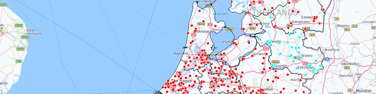
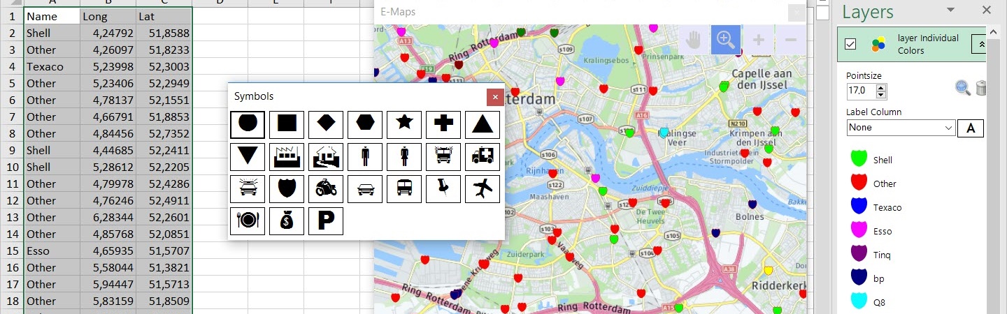
Experience the power and ease of use of E-Maps.
E-Maps is designed for Excel 2007 desktop or higher.
Download E-Maps now!

E-Maps makes use of different worldwide roadmaps and aerial pictures, independent of the version. For the use of E-Maps an internet connection is required. The Excel add-in uses the map service from Here ™ (Nokia / Navteq) for the roadmaps, hybrid maps aerial pictures and the geocoding of addresses and zip codes from the Excel data.

E-Maps is specially created as a mapping tool/GIS viewer for Microsoft Excel 2007, 2010, 2013, 2016, 2019 and Office 365 (desktop). E-Maps for Excel™ is available in three versions (click here), from basic functionality to extended options. No matter which one you choose, they are all easy to use.

The variants

  1. Standard – worldwide geocoding based on full address, postal code or city. Background maps ranging from From High quality maps from Here ™ to a blank map.
  2. Pro – all features of the Standard version plus extra background maps and enhanced selection capabilities like circle and marquee. Import your own Esri Shape file as background layer or colour it as a thematic map.
  3. Advanced – all features of the Pro version plus advanced selecting and drawing capabilities. Make a selection of locations based on travel time and/or -distance from a given point using car or walking. Draw a line, circles, shapes or a point to enhance your maps

Take a look at the overview of the functionalities. After the installation, the add-inn will be added to the menu-bar and E-Maps is fully integrated in Excel, just like DataMap in Excel 97/2000 was integrated in Excel

E-Maps ribbon

Download the free trial or buy a license through the webshop. Ordering E-Maps is easy. After the registration and order, you will receive a download link and a license. You can start immediately.