Skip to content
Excel E-Maps

Excel E-Maps

Mapping your data in Excel

Menu

  • Home
  • Specifications
    • E-Maps
    • E-Maps mobility
  • Tutorial
    • Quick start
      • Installing E-Maps
      • Starting E-Maps
    • Add data
      • Geocode
      • Coordinates
      • Shape
    • Manage layers
      • Layer control
      • Add labels
      • Point styling
    • Thematic maps
      • General
      • Thematic shading
      • Pie chart
      • Heatmap
    • Selection
      • Object selection
      • Boundary selection
    • Export
      • Project File
      • Clipboard
      • Print
      • PDF
      • Image
    • Other
      • Background map
      • Find location on map
      • Drawing
      • Statistics
      • ISO3 countrycodes
  • Buy now
  • Download
    • Download trial
    • Update page
    • Free data and maps
  • Support
    • Video’s
    • FAQ
    • Privacy Statement and Terms of Use
    • Newsletter
    • Contact
  • Nederlands

gisviewer

MapPoint

MapPoint

What is MapPoint?  Since 2000 organizations used Microsoft MapPoint for quick geographic insights. The tool had background maps for large parts of the world. Within the most countires, you were able to geocode addresses. The software and the maps had

Erik van Hunnik 13 December, 202126 September, 2019 Read more

ISO3 country codes

ISO3 countrycode Looking for an Excel tool to geocode addresses worldwide? Download the 14-day trial version of Excel E-Maps. ISO3 Country name ABW Aruba AFG Afghanistan AGO Angola AIA Anguilla ALA Åland Islands ALB Albania AND Andorra ARE United Arab

admin 12 December, 201317 December, 2021 Read more

63.000 Dutch monuments plotted on an Aerial map

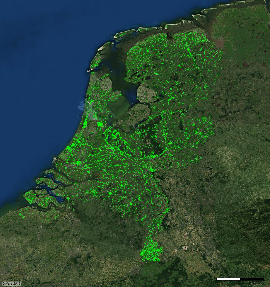
63000 Rijksmonumenten in Excel E-Maps

More than 63.000 monuments in The Netherlands are plotted on a Here map with Excel E-Maps. The X and Y coördinates that we used, came from the file that we downloaded from the ‘Cultureel Erfgoed’ (Cultural Heritage).        

admin 10 December, 20139 March, 2018 Read more

Address matching with result code

We added the funtionality to display the result of address matching (geocoding) as an extra column. This feature enables you to check the quality of your addresses and location of the points on your map. Preferably, a country code will

admin 29 October, 201312 December, 2013 Read more

Download

Read the License Agreement before you activate E-Maps.

Newsletter

    News

    • MapPoint
    • 45 seconds demo script
    • Three simplified maps
    • E-Maps Advanced for time and distance selections
    • The ruler
    • New symbols for thematic
    • Statistics of the selection
    • Circle selections are standard in E-Maps Pro
    • Adjustable colours and ranges in heatmap
    • Coffeeshops and schools in Amsterdam
    • New video tutorials for 2.0

    First Element Maerten 29, 2628 RC Delft, The Netherlands - Phone: +31 15 2190885 - Email: office@firstelement.nl