Skip to content
Excel E-Maps

Excel E-Maps

Mapping your data in Excel

Menu

  • Home
  • Specifications
    • E-Maps
    • E-Maps mobility
  • Tutorial
    • Quick start
      • Installing E-Maps
      • Starting E-Maps
    • Add data
      • Geocode
      • Coordinates
      • Shape
    • Manage layers
      • Layer control
      • Add labels
      • Point styling
    • Thematic maps
      • General
      • Thematic shading
      • Pie chart
      • Heatmap
    • Selection
      • Object selection
      • Boundary selection
    • Export
      • Project File
      • Clipboard
      • Print
      • PDF
      • Image
    • Other
      • Background map
      • Find location on map
      • Drawing
      • Statistics
      • ISO3 country codes
  • Buy now
  • Download
    • Download trial
    • Download page
    • Free data and maps
  • Support
    • Video’s
    • FAQ
    • Privacy Statement and Terms of Use
    • Newsletter
    • Contact
  • Nederlands

The ruler

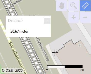
A simple addition can have a great effect. We added a ruler to the map window.
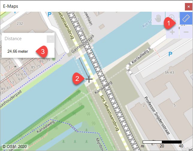
  1. Select the Ruler
  2. Click on the map to activate the tool
  3. Move the cursor and read the value in the Distance window
multi-click distance

The ruler
Erik van Hunnik 12 May, 202012 May, 2020
  • ← New symbols for thematic
  • E-Maps Advanced for time and distance selections →

Download

Read the License Agreement before you activate E-Maps.

Newsletter

    News

    • E-Maps Advanced for time and distance selections
    • The ruler
    • New symbols for thematic
    • Three simplified maps
    • Statistics of the selection
    • E-Maps project
    • Circle selections are standard in E-Maps Pro
    • Adjustable colours and ranges in heatmap
    • Use a Shapefile in E-Maps
    • Coffeeshops and schools in Amsterdam
    • Excel Mobility Pro
    First Element Scheepmakerij 11, 2628 AA Delft, The Netherlands - Phone: +31 15 2190885 - Email: office@firstelement.nl